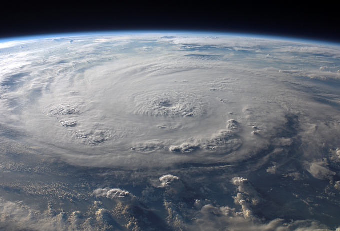
Nov. 30 designates the calendar end to an almost six-month-long season of hurricanes and tropical depressions. However, when November passes and December comes, the Atlantic sometimes chooses to ignore the placards of man, ravaging on with storms until the ocean is finished. Just this past week, Iota devastated Nicaragua and Central America following directly in the steps of Eta who, just two weeks prior, destroyed Central America as well. A season of high activity called for the Greek alphabet in addition to the English alphabet to name the record number of hurricanes that have torn through the Atlantic. Just as it seems to be coming to a well-deserved end, two areas of energy appear in the Atlantic Ocean. With 30 tropical storms, 2020 has beat out 2005, which never made it to Eta, stopping abruptly at Zeta. With two swells on the rise, it is possible that Kappa could be next up.
Two areas have a low percentage of progressing into tropical storms, each having a 20 percent chance. However, this year proves how quickly events can change or escalate in a matter of days or even hours. Off the east coast of Florida lies one of the areas to watch, with the potential of a storm forming between the Bahamas and Bermuda. The other area to watch appeared off the coast of Costa Rica, heading southwest in the Caribbean. With water temperatures dropping, the likelihood of a hurricane hitting the United States is unlikely. Yet, the temperatures of the water in the tropics is still uncharacteristically high, generating high alert with potential storms still to come. Regardless of their formation, there is vast concern that any storms could cause major flooding and landslides in areas already ransacked by Eta and Iota. For now, Kappa is a mere thought and with a week and a half to go, hopefully she is never realized.

Various nicknames are given to the monstrous storms: typhoons, cyclones and hurricanes. These storms by any other name are just as catastrophic. Storms are appointed names based on the ocean in which they form. Typhoons are native to the Western Pacific, cyclones the Indian Ocean and hurricanes the Atlantic and Eastern Pacific. The scientific term for these storms is tropical cyclone. They form when there is a lack of warm, moist air, creating an area of low pressure over warm water. Surrounding areas with high pressure push into the low-pressure areas and take in the warm, moist air then also rising. This process continues on an endless cycle; when the warm air rises, cooling off, clouds are formed and power winds that spin the storm dictated by the Earth’s axis. There are five categories that determine the strength of a hurricane. When measuring a storm wind speed, damage at landfall and storm surge determine the overall category of the tropical cyclone.
Many Americans experienced Hurricane Irene in 2011 and Hurricane Sandy in 2012, so they have seen up-close the aggression and demolition of such storms. Both Category threes demolished New Jersey, killing many and inflicting billions in damages. Livelihoods are decimated and families broken, but out of the rubble comes rebirth and rebuilding. With relief aid and donations, these storms are survived. Getting through a year full of phenomena and tragedies, such as two Category four hurricanes striking within 20 miles of one another in less than two weeks, proves that life continues and that there always comes an end and a chance to fix what is broken.
Want to see more HCFSU? Be sure to like us on Facebook and follow us on Instagram, Twitter, TikTok, Youtube and Pinterest!


